Many winter sports enthusiasts ask themselves after a successful day’s skiing: How many kilometres of pistes have I actually covered today? Thanks to the new ski recognition feature, With 21 of its own apps, iSki provides useful digital helpers for skiers and snowboarders. On the smartphone, you can track your kilometres on the slopes via GPS and get even more details. SnowTrex shows how the iSki app does this and what else it can do.
What is iSki?
For winter sports enthusiasts, the free apps from iSki are indispensable companions on the smartphone. The digital assistant not only knows its way around 2,200 ski resorts around the world thanks to detailed, interactive piste maps. Thanks to the GPS function, iSki can also be used to track kilometres of slopes and document the entire skiing day in detail. There is now a separate iSki app for 17 different ski destinations such as Austria, Switzerland and France. In addition, four more smartphone apps have been developed: “iSki World” for other ski resorts worldwide, “iSki X” for freeriders, “iSki Nordiq XC” for cross-country skiers in Switzerland and the stand-alone “iSki Tracker”.
In addition to GPS tracking while skiing, all 21 apps offer many additional functions that are perfectly tailored to the needs of skiers and snowboarders on the mountain. These include detailed live information on snow conditions, weather forecasts and real-time data from the ski resorts such as lift opening times, slope conditions and webcams.
How to track piste kilometres with iSki
Skiing and tracking kilometres is easy with iSki. The piste kilometre app uses the GPS sensor built into smartphones to record the course of runs in the ski area. Skiers and snowboarders must therefore first activate the GPS on their mobile phone before starting their day on the slopes. This allows the app to access the location via mobile internet without using any data, determine the exact position on the piste and track movements in real time. And that’s how iSki does its thing:
- Start tracking: Before the first descent of the day, tracking must be switched on manually in the iSki app for skiers so that all movements on the slopes can be recorded. This allows the app to collect parameters such as kilometres covered, altitude, speed and the duration of the runs.
- Recording of runs: On the piste, the app records the route travelled on the slopes and records it on a map. The iSki app uses the GPS data and compares the position with the piste maps to determine which slopes and lifts the user was travelling on.
- Piste kilometre statistics and evaluation: After the day’s skiing, the recorded data can be viewed in the app. The iSki app presents the kilometres skied on the slopes, maximum speeds, vertical metres and the duration of the runs in a clear dashboard.
- History and personal best performances: The app saves the recorded data so that several days of skiing can be compared and progress can be tracked. Personal bests, such as the longest distance or the highest speed, can be called up and compared with previous results.
What else the iSki app can do
The iSki app can not only measure kilometres of slopes, but also shines as a digital helper away from the slopes. Firstly, the “iSki News” function clearly displays details such as the current snowfall forecast or the largest ski regions in the vicinity and much more. And if you use the corresponding tab to select the ski area you are currently in, you will also find the “iSki Hut Finder”. Here, the app provides information on all mountain huts in the ski area, shows how far away they are and how long they are open. This also makes iSki a useful après-ski tool.
Other useful apps for skiers
skiresort.de
The skiresort.de app offers winter sports enthusiasts numerous useful functions with detailed information on 6,000 ski resorts worldwide, such as snow depths, lift status and weather forecasts. Users can call up interactive piste maps, view live images from webcams and get a quick overview of lifts and pistes in the current ski resort.
White Risk & SnowSafe
The “White Risk” and “SnowSafe” apps have been specially developed for skiers, ski tourers and freeriders to act as an offline avalanche warning system and provide comprehensive safety information. “White Risk” offers real-time data on avalanche danger and snow conditions, while “SnowSafe” provides safety information, emergency contacts and piste rules for Austrian ski resorts.
PeakFinder
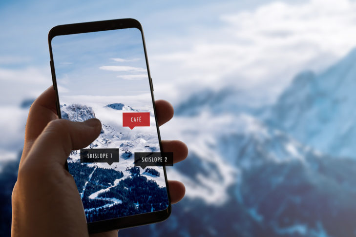
PeakFinder is an app that can identify over a million mountains worldwide by using the smartphone camera and GPS to create a 360-degree view of the surrounding area. With the help of augmented reality, it shows the names, heights and distances of the mountains directly on the display and also works offline. Locations can also be saved and shared with others, making it particularly useful for remote areas.
But what other smartphone apps besides iSki can win over ski enthusiasts? SnowTrex knows and presents the best ski apps for winter sports enthusiasts.
FAQ’s on tracking piste kilometres
How can winter sports enthusiasts track their kilometres on the slopes with the iSki app?
With the iSki app, skiers and snowboarders can easily track their kilometres on the slopes using the GPS function on their smartphone. To do this, the GPS must be activated on the smartphone and the ski tracking technology must be switched on in the app before the first descent of the day. The app then records the kilometres of piste covered, altitude and speed in real time.
What additional functions does the iSki app offer besides piste kilometre tracking?
In addition to piste kilometre tracking, the iSki app offers many other useful functions such as live information on snow conditions, weather forecasts, lift opening times and an interactive piste map. Winter sports enthusiasts can also use the “iSki Hut Finder” to find mountain huts in their vicinity in the ski area and check their opening times and distances.
Can winter sports enthusiasts use the iSki app to compare skiing days and save their personal best times?
Yes, the iSki app saves the recorded data from the ski area so that skiers and snowboarders can compare several days of skiing with each other. Here they are also able to call up their personal best performances, such as the longest distance or the highest speed, at any time and compare their progress with previous results.


